
ARS Applications
Military and UAS
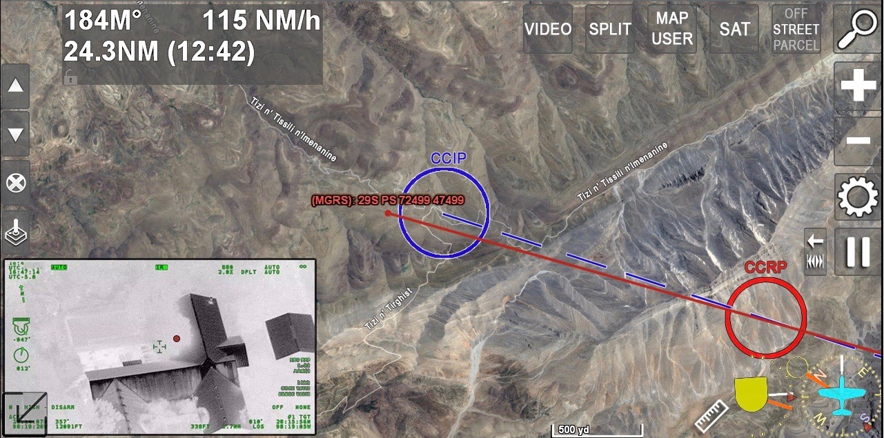
Augmented Reality Mapping for Military and Unmanned Aerial Systems
ARS is a TRL 9 flight proven mission management system that can be easily customized to interface with a broad range of equipment and signals. The system displays an array of critical information for the latest in situational awareness and decision making.
ARS includes high resolution imagery, DTED data, 3D map imagery, inclusion of NIMA and NGA data and can display a wide range of geo-located points of interest. Overlay information such as ADS-B traffic locations, weather, RADAR targets, and BFT icons on top of real time EO/IR video, giving users selectable and accurate layers of data to aid in split second decision making. All information can be presented and controlled from a single source, saving space, weight and power (SWAP), and keeping the operator focused on the target.
Digital Moving Map / Mission Computer with built-in Cursor on Target (COT) and MTI integration
Display EO/IR camera’s line of sight and field of view information on-screen
Terrain avoidance features on top of live video or overlaid over a map (topographic, aerial imagery, etc.)
Integration with radio/mesh networks, ADS-B, RADAR, and AIS data type information
DO-160 certified
Includes lifetime software updates and an industry-leading 100% satisfaction guarantee
UAS and Optionally Piloted Aircraft

Utilizing a bidirectional datalink, ARS can be installed in UAS platforms and controlled from the ground. The system can be used to steer the camera to specific locations.
The video and information can be recorded and down-linked back to the ground for up to the minute analysis and review. The entire mission can be controlled and reviewed from an operational command center on-ground.
Contact Request
Looking for a quote or have a question about our products? Fill out the form below and a SHOTOVER Systems team member will get back to you right away.
Aircraft equipment and demonstration configurations vary by project. Contact SHOTOVER to discuss the sensor fit, scope and availability for your evaluation.