
ARS Applications
Aerial FireFighting
Accurate, Real-Time Fire Mapping
Perform Fire Mapping Directly on Top of Sensor Video in Real-Time.
Operators can place geographic markers, create, modify, and combine polygons, as well as calculate the acreage of a polygon and measure distances. Markers, lines, and polygons created on-board the aircraft can be exported using common GIS formats.
The ability to create an accurate map of a wildfire or any other incident is literally at your fingertips. With ARS and a touch-screen display, the operator simply needs to touch the screen to create a real-time perimeter polygon. These polygons can then be downloaded to an incident commander or operations center using common GIS formats.
Built-in features for Quick and Accurate Perimeter Mapping
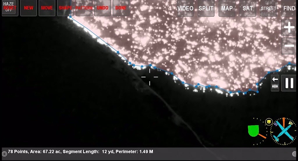
Fire mapping in ARS uses any one of several options – touchscreen, keyboard, camera, or even the aircraft, to trace the perimeter of the fire
Custom maps, imagery, POIs, and vector data: trails, park maps, landing zones, topographic maps and much more
Built-in GIS export lets save polygons directly to inexpensive removable USB media or email directly from the aircraft (if equipped)
Mark the location of hotspots by simply touching the screen. Save and export to USB or view coordinates live, on-screen
Multiple coordinate systems and real-time coordinate conversion lets you handle any type of location data
Contact Request
Looking for a quote or have a question about our products? Fill out the form below and a SHOTOVER Systems team member will get back to you right away.
Aircraft equipment and demonstration configurations vary by project. Contact SHOTOVER to discuss the sensor fit, scope and availability for your evaluation.