
ARS Applications
Airborne Law Enforcement
Maintain Optimal Situational Awareness
View streets, addresses, infrastructure, vehicle locations and other critical information directly on top of sensor video in real time. ARS combines all relevant mission information onto a single display, allowing TFOs the freedom to stay focused on the target and mission, rather than dividing their attention between multiple sources for video, mapping, and target information. The system’s intuitive design enables a wide range of map data display options and allows for new interface and control options per customer feedback.
Eliminate the need for stand-alone video recorders with ARS’s built-in recording capability.
Use our extensive imagery and GIS databases or import your own data (or let us import it for you for at no cost)
See something and want a closer look? Pause and replay while you are still recording.
Lifetime software updates included
Backed by industry-leading service and support
Never Miss A Moment: In a pursuit, ARS shows streets, intersections, direction of travel, speed and much more on a single display so you can have ultimate situational awareness.
Don’t guess the address. Know it.
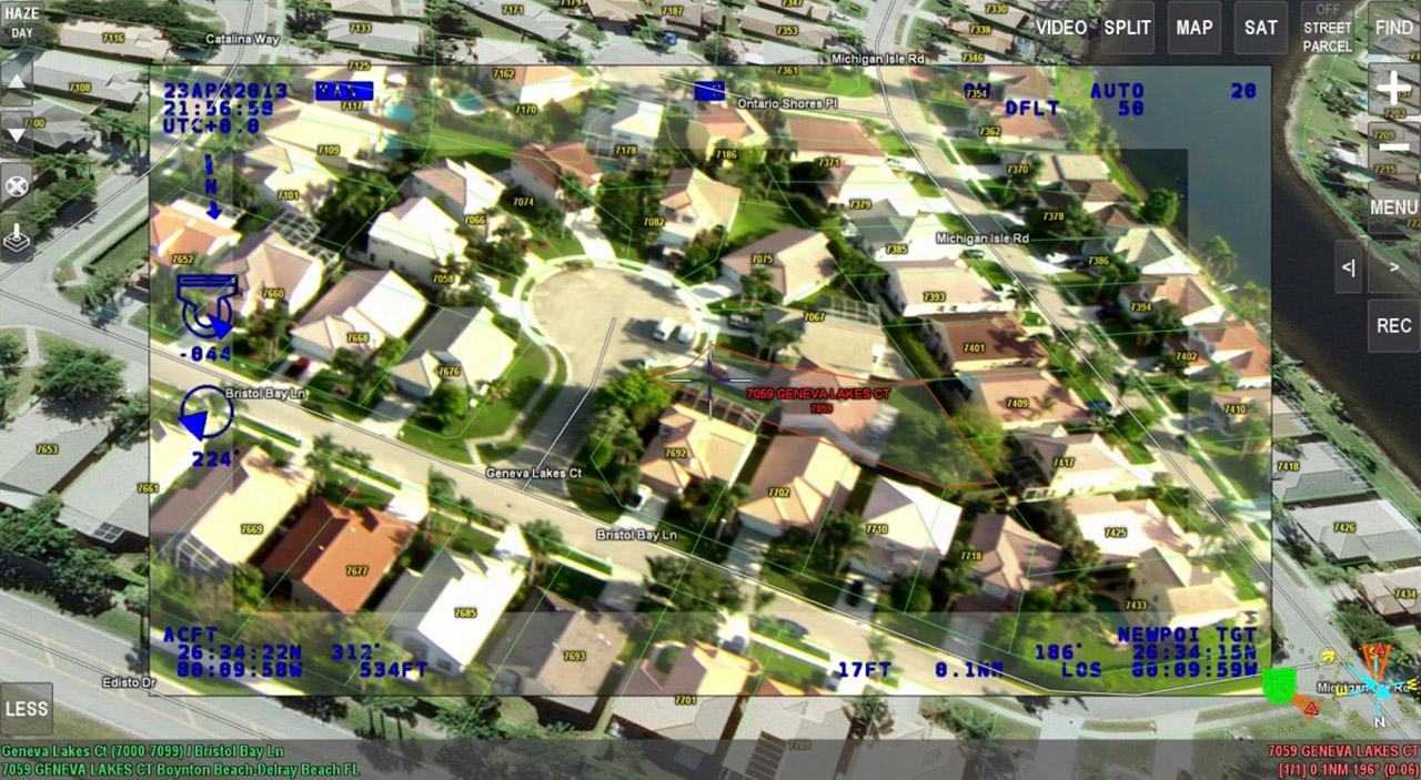
ARS features comprehensive, rooftop-accurate parcel data that gives you the confidence to know exactly where the suspect is. Use our extensive GIS data library, import your own, or let us import it for you. When the suspect is on the run, you’ll have total confidence in the pursuit.
Contact Request
Looking for a quote or have a question about our products? Fill out the form below and a SHOTOVER Systems team member will get back to you right away.
Aircraft equipment and demonstration configurations vary by project. Contact SHOTOVER to discuss the sensor fit, scope and availability for your evaluation.